I have been working with the US Forest Service Fourteener Program Manager Loretta McEllhiney since 2015 in the Navajo Basin. We have scouted new trail routes and walked our alternatives with specialists, so we could start designing a sustainable route up to the class 3 section of Mount Wilson.
So what are the reasons for designing a new trail on Mount Wilson, which will start from Navajo Lake and lead all the way to the class 3 approach? This trail is part of the Rock of Ages trail, which has a lot of history of old mines. Much of the current trail alignment is part of these old mining cart roads that have held up for at least a few hundreds of years. However, some of the trail dips down into a few riparian areas, which is unnecessary and tough for hikers to walk through. The current trail corridor becomes wet and mucky, and hikers usually try to avoid the mud by hiking off trail. Also, when climbing a fourteener most folks do not enjoy losing elevation multiple times on the ascent.
The rerouted trail would allow for better drainage and help reduce the amount of erosion occurring in the fragile alpine tundra. Another reason McEllhiney and I thought to move this trail was due to the presence of large snow fields which hang around late in the Spring. Last season, we surveyed the snow and recorded that about 75% of the basin sat in snow. A large portion of the current trail was disguised by this lingering snow. Therefore, the average hiker was unable to see the trail, despite a few constructed cairns along the route.
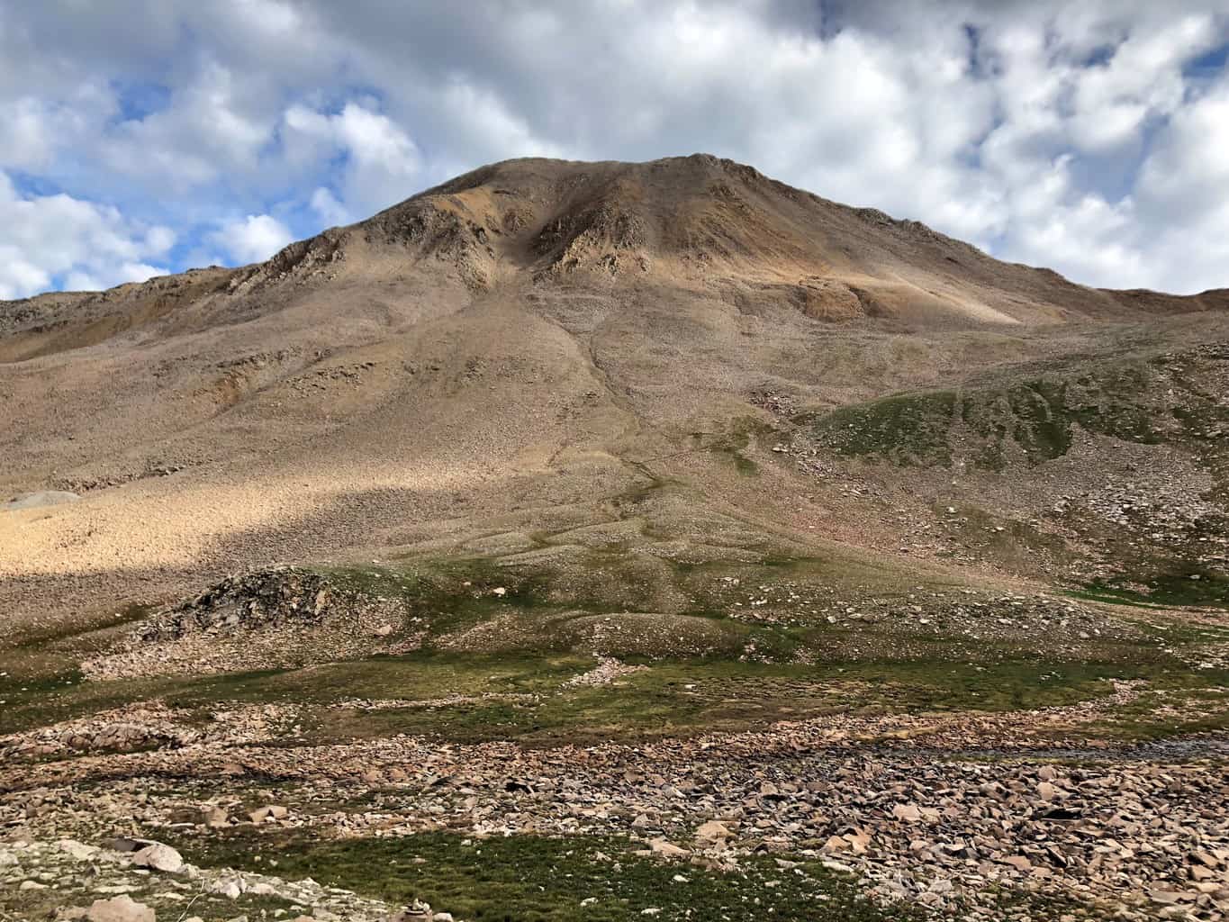
Meandering terrain caused by glacier melt. Our new trail will pass through this talus slope.
These wandering footsteps do a lot of harm to the alpine in the early Spring. The snow is soft and the ground underneath is hyper saturated. The alpine during this time is just starting to wake up from dormancy and is even more sensitive to trampling. It can take as little as five footsteps to kill an alpine plant and hundreds of years for it to grow back. Designing a trail in talus protects from this type of resources damage, makes a more enjoyable hike, and provides the construction crews with great material to build.
Loretta and I have scheduled two 10-day trips to finish the design process. We hope that CFI can start construction on the new route (funding dependent) at the start of the 2019 field season. We just finished our first 10-day trip and progress has been good. A total of 1.1 miles is projected to be built in the Basin. We currently have over half of our construction notes for the multi-year project. We are halfway up the hillside to the technical section of Mount Wilson, but that is where the design starts to get challenging. Since we can’t build a new route on this section due to the Spring snowfields, we will be forced to reconstruct the current user-created route. The lack of suitable building materials in this section will make this a complicated and challenging section to build. Some sections will require a cable tram system similar to the one currently being used on the Mount Columbia trail reconstruction project. If a tram system cannot be set up, we may not be able to harden the trail surface all the way to the start of the class 3 scramble. The next 10-day trip we hope to accomplish the small re-route around the lake (0.3 miles). This starts around the willows near the lake and upper camping areas, then joins the existing trail which will be used for about one mile before our new trail reroute begins.
Normally when we reroute a trail to make it more durable and sustainably-aligned, the trail reroute ends up being at least one mile longer than the original due to the addition of switchbacks and relocating the corridor to find a sustainable grade. However, the new Wilson route will not be too much longer than the current trail. The entire re-routed section will be 1.1 miles, and the current trail alignment that will ultimately be closed and re-vegetated is 1 mile in length. An additional 0.6 mile of reconstruction work will occur to harden and fortify the current social trail.
Despite needing several seasons of intensive trail maintenance and restoration work, the Navajo Basin route on Mount Wilson is one of the least trafficked routes I’ve seen in all my years working as a 14er Trail Designer. This is a great break on the eyes and soul after seeing the high use on Front Range Fourteeners. There is some resource damage on the mountain that is cause for concern, but it is not as bad as some mountains where the trail averages over 30-ft wide or has erosive gully’s that are three to four feet deep. For Mount Wilson, the future is very bright!